

Baiyangdian: Re-engineering the "Pearl of North China" into a model of Ecological Civilization
Baiyangdian: Re-engineering the "Pearl of North China" into a model of Ecological Civilization
At the center of Xiong'an New Area is Baiyangdian, a large freshwater wetlands being remade into a model of "ecological civilization" through intensive re-engineering.


About 100 km south of Beijing is a wetland called 白洋淀 Baiyangdian—referred to as the “kidney of North China” 华北之肾 for its role in draining the Northern Hai River basin, or the “Pearl of North China” 华北明珠 for its picturesque landscape of lotus flowers and unique ecology and water villages. In 2017, the fate of Baiyangdian underwent a dramatic turn with the declaration of the Xiong’an New Area. At once, a 2000 km2 region surrounding the wetlands were transformed into China’s “third new area of national significance,” and a “growth pole for Northern China.”
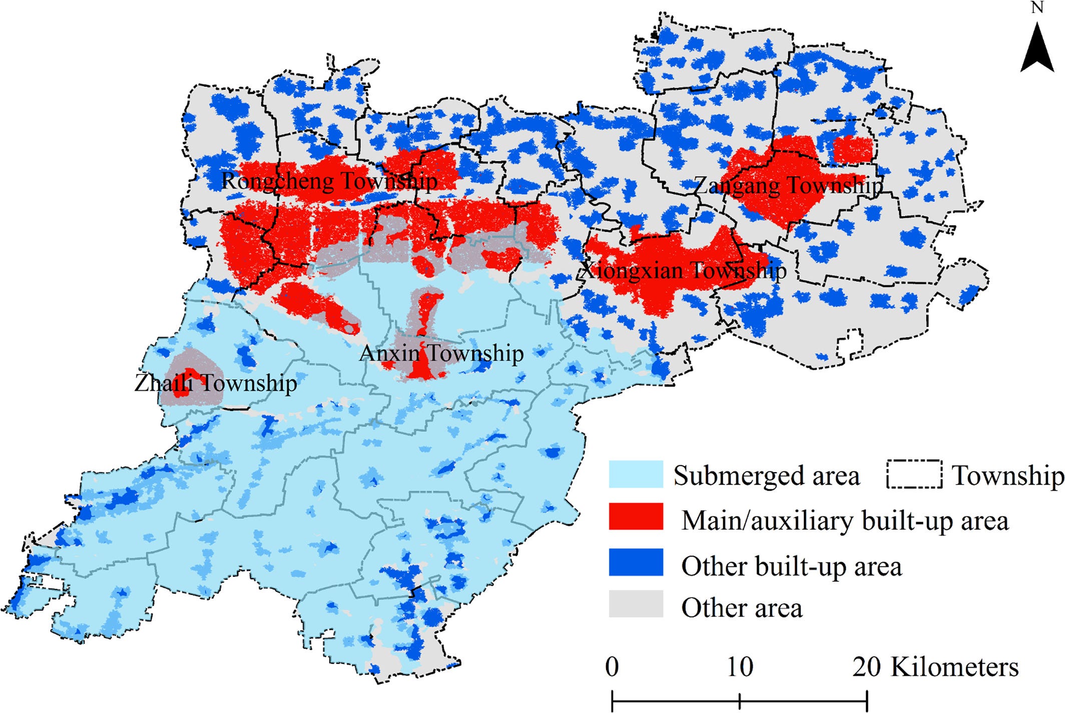
The wetlands provided planners and government officials a romantic narrative of new urbanization in harmony with nature “tianren heyi”, but also presented serious risks. Lying 8 or 9 M below the long-term floodline, the floodplain just to the north of Baiyangdian where the core Qidong District was to be built was inundated in the catastrophic 1963 floods. A landscape architect who consulted on Xiong’an early on but was ultimately not part of the planning team, joked wryly to me that, “it’s low-lying, there are floods, earthquakes, it’s a great place for a new city.” One of the reasons the area may have been chosen was that there were fewer villages in this stretch of land than nearby areas—but this was for a reason. Settlement and construction in the river flood basins in the area had been discouraged since 1963. However, Yin Zhi, head of Tsinghua’s Design institute and one of the chief planners of Xiong’an, believed dry conditions were now more of a problem than flooding and that construction of new reservoirs made such a catastrophic flood unlikely again the future. Xu Kuangdi, former Mayor of Shanghai and head of the commission on Jing-Jin-Ji’s planning declared that Xiong’an would be “an ecological and liveable city that blends water and city, blue and green reflecting each other.” The wetlands thus provided an opportunity to showcase environmental engineering and infrastructure technology, and tell a story of “Chinese-style modernization” integrating development with ecological civilization or shengtai wenming "生态文明, a slogan that has become a favored envelope concept for China’s environmental policies to try to distinguish China’s approach from Western countries.
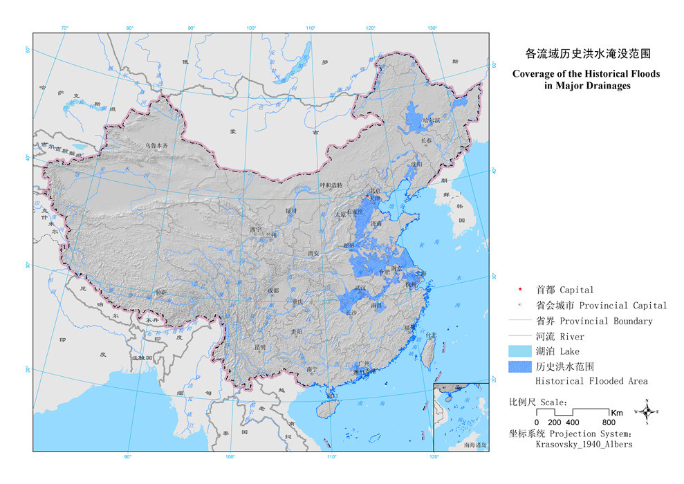
The North China Plains or huabei pingyuan 华北平原 are the northern half of the vast alluvial plains of the Yellow River basin in which Chinese civilization first emerged. Today, the region extends across the provinces of Henan, Western Shandong, Hebei, and Beijing and Tianjin. The region is arid and dry but home to upwards of 300 million people, home to fertile farmland, industrial cities, but vulnerable both to the long-term impacts of climate change as well as periodic flash floods, which have been a recurring phenomenon throughout history.
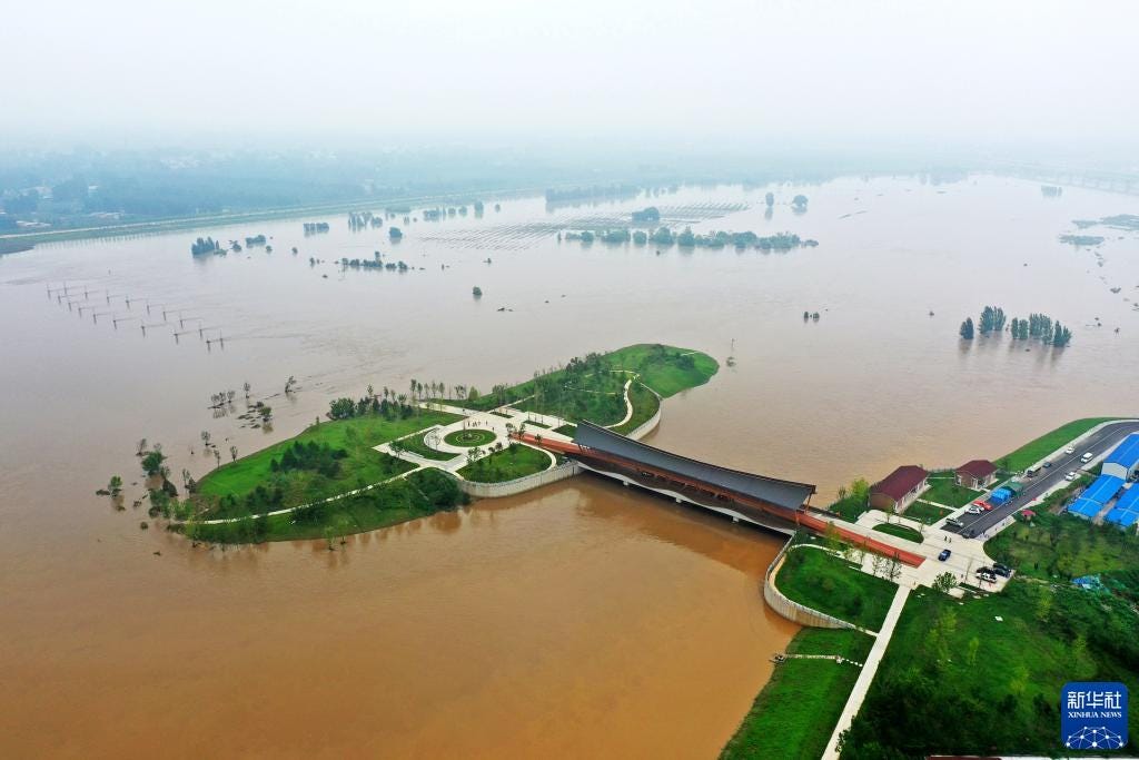
In late July and August of 2023, Beijing experienced the heaviest rains in 140 years and flooding in the region on a scale unseen since the Hebei floods of 1963. The city of Zhuozhou 涿州, which lies upriver on the Nanjuma River 难拒马河 from Xiong’an, was completely inundated with floodwaters pouring down from the Tai mountains to the West. Ni Yuefeng 倪岳峰, Hebei’s Party Secretary, called on areas bordering Beijing to “resolutely serve as a ‘moat’ for the capital.” There was speculation that the town was sacrificed to prevent floodwaters from reaching Daxing Airport and Xiong’an downriver, though this couldn’t be explicitly verified.
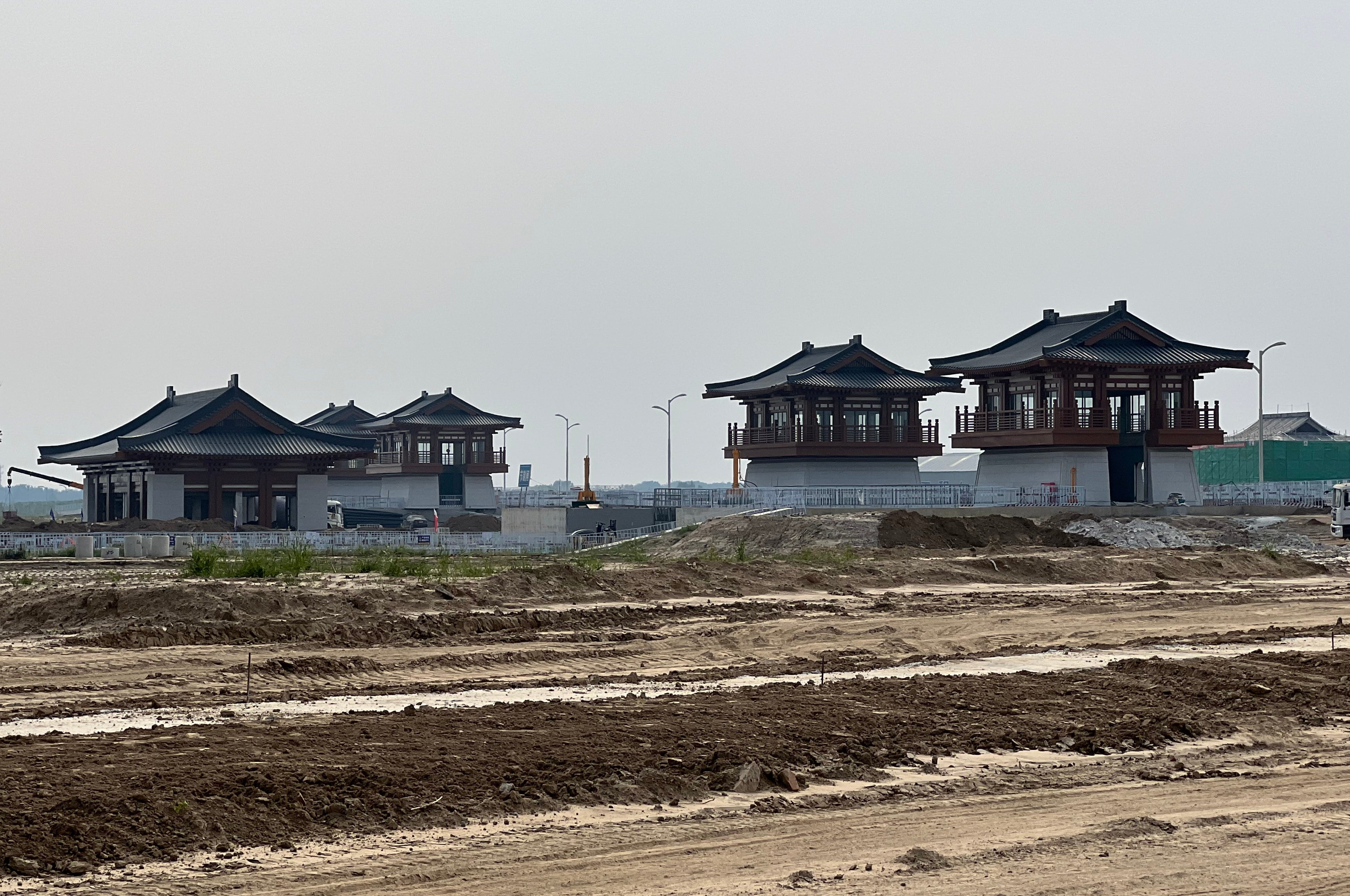
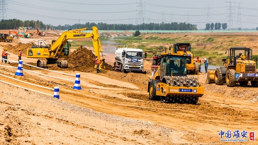
Even if Xiong’an was spared this time, there remain serious doubts about the city’s precarious location. Planners and engineers are well aware of this and have been building a series of infrastructures including flood spillover basins, parks designed to absorb excess rainwaters, extra levees around Baiyangdian, and new flood gates. As an employee for a developer who worked in Xiong’an during the first two years of construction told me, “there was a bit of a joke at the time among some staff that while Xiong’an was talked about as this harmonious ecocity integrating with nature, in fact what was being built were giant levees and walls to prevent flooding, it was a bit of a contradiction.” Many of these projects have been undertaken by Xiong’an Group’s subsidiary Xiong’an Group Ecological Construction company 雄安集团生态建设公司, as well as by large SOEs Power Construction Corporation of China (中国电建), and 葛洲坝集团 Gezhouba Group, a Hubei-based SOE building and operating dams in central China.
Climate Change, Urbanization, and an “Ecological Security” Framework
Yu Kongjian, the dean of Peking University’s Landscape Architecture program and founder of the successful landscape architecture firm Turenscape, developed a
Nationwide Ecological Security Plan in 2009, integrating data on a wide array of environmental risks and natural capital—areas of high flood risks, areas of sensitive flora and fauna, areas of highly productive cropland. 1The process of combining these different factors spatially is the logic of “suitability analysis”, a key tenet of geographic information systems developed by Ian McHarg and used widely now in geographic information software like ESRI’s ArcGIS. For Turenscape, the picture of China’s overall ecological risks generated a map of areas that are absolutely necessary to protect, as well as areas that would have lower risks if they were developed. Xiong’an, lying in a low-lying flood-prone region is by these measures not the ideal place to locate a new megacity. Yu has advocated for building any new settlements in intermediate “foothill” areas, such as to mitigate flood risk.
Engineering Baiyangdian into a Model of Ecological Civilization
From the beginning of Xiong’an New Area’s creation in 2017, the restoration of the Baiyangdian wetlands has been a central focus of work and propaganda/messaging. One of the first regulations in the area was to close polluting factories. This has improved the water quality but also resulted in unemployment among locals. Nevertheless, the improvement in water quality has been noticeable in the area, and this was often mentioned to me by locals, even those who were otherwise annoyed by the loss of factor jobs.
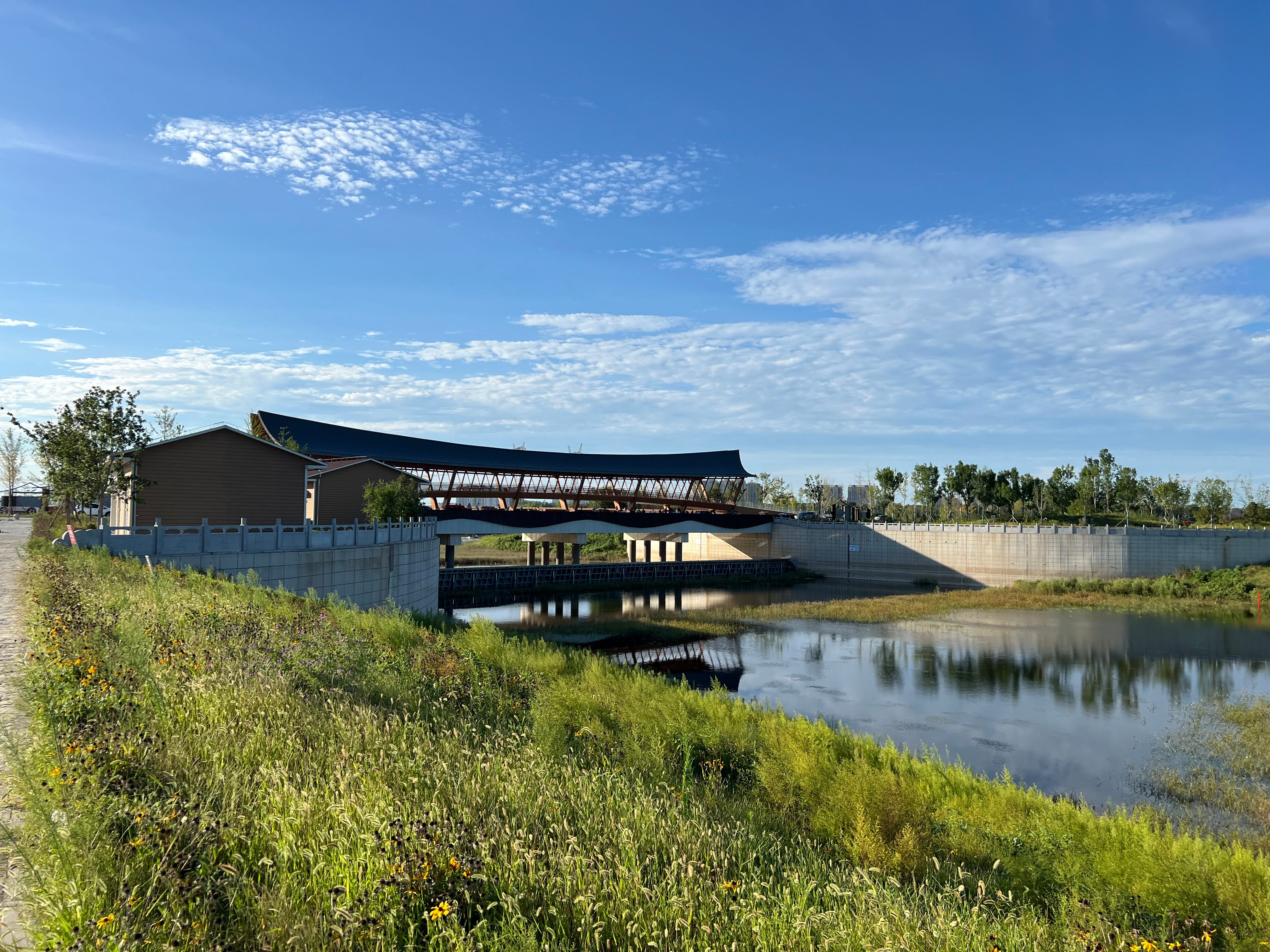
But mitigating the risk of flooding is a more arduous task that has required significant investment in levees, new locks, sluice gates, and man-made river valleys that are running through the new area. According to a planner who worked in Xiong’an, almost all of the land plots in the city had to be raised up 3 meters in order to reduce flooding risk.
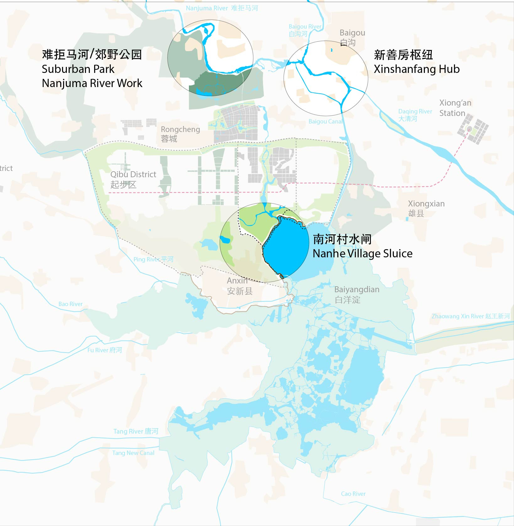
新善房枢纽 Xin Shan Fang Hub: a key flood diversion node: was built to control water flow from the Nanjuma river into the Baiyin gou canal, which forms the Eastern edge of Xiong’an’s new Qidong District and flows into Baiyangdian.

Nanhe cun Shuiza 南河村水闸
This sluice gate separates Baiyangdian wetlands from a new water network being built in the center of Xiong’an’s CBD.
Nanjuma River Work 难拒马河工程: The nanjuma river flows south from the Taihang mountains. This is the largest river feeding into the area and the source of flooding in August of 2023—Zhuozhou upriver was severely flooded. The area along the river north of Xiong’an has been remade to include new higher levees, and new floodeable runoff basins designed to be floodeable during high water.
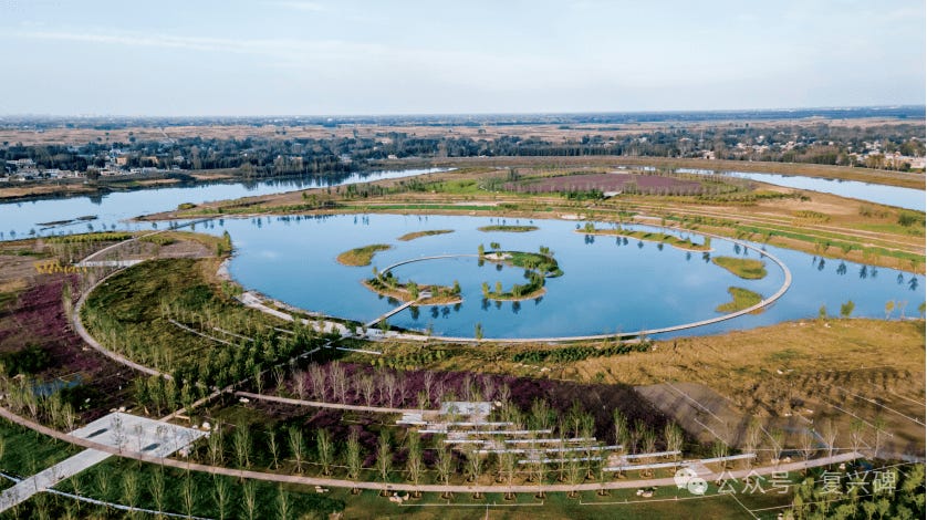
Suburban Park 郊野公园
A large park has been built between the northern edge of Xiong’an’s Rongdong District and the Nanjuma River—the park features rivers and hills designed to absorb excess water in the event of flooding.
Conclusions
There has been enormous investment in ecological engineering to improve the water quality, mitigate flood risk, and otherwise re-engineer Baiyangdian into a model of a Chinese ecocity in harmony with nature. However, this strategy raises a number of questions: how resilient will such infrastructure be in the face of increasingly frequent flooding? Will locals, such as villagers who have lived on the wetlands for generations, be allowed to stay, or will they be relocated in order to turn the wetlands into a pristine protected park? Some villagers I spoke with, who run tourist boat tours, said in the future they may have to move, and speculated that expensive villas will be built in the wetlands at some point. While Baiyangdian has been celebrated as a “pearl of North China”, its symbolic appeal leveraged for the new area’s development, the engineering and relocation work could transform the entire ecosystem into something. The amount of investment in new heavy urban construction means building new infrastructure that will protect such investment but also potentially destroy natural ecosystems and create more fixed hard boundaries between water and land, whereas the wetlands have always been in constant flux—growing and shrinking with changing rainfall, floods, and other natural events. This “heavy engineering” approach is entirely consistent with decades of environmental management strategy in China, but it also challenges the idea of humans and nature living side by side—instead nature could be remade into a decorative backdrop. In this case, nature is simply made to serve the needs of modern technological development. Traditional livelihoods are being discouraged or even rendered impossible in the current transformation of the area. Xiong’an, therefore, exemplifes a continuation of longstanding Chinese approaches to reconstructing natural environments —from the Three Gorges Dam, to the North-South water Transfer, to the Great Northern Shelterbelt. Baiyangdian may yet continue to be a “Pearl of North China”, but it will not be the same pearl it was for generations.