Coordinated Regional Development: from Slogan to Showcase 长三角一体化模范区
An interview with a planner of the Yangtze River Integrated Development Zone

Integrated Development: From slogan to reality
On a recent visit to Shanghai, I visited Tongji University’s Planning Institute 同济大学建筑设计研究院(集团)有限公司, where I met with one of the planners who helped design the “Waterfront Lobby” project, a centerpiece of the Yangtze Delta Coordinated Development Model Area, a 2300 sq km area at the intersection of Shanghai, Jiangsu, and Zhejiang. Why was I interested in this project? For one, the project is one of the first tangible outcomes of efforts to promote more cross jurisdictional planning—something emphasized since China’s 2014 New Type Urbanization Plan but mostly a conceptual idea.1 The effort to exert greater cross-provincial and cross-municipal planning coordination also reflects efforts under Xi’s administration to control runaway municipal-driven planning. In 2018, a ministerial reorganization combined some departments of the MOHURD (Ministry of Housing Urban Rural Development) into a new Ministry of Natural Resources 自然资源部. This new ministry would have greater control over what is being called “national space planning” or 国土空间规划, which aims to integrate the hitherto autonomous process of local land use planning into a nationwide database, or “one map” 一张图.2 To put it mildly, such an attempt at centralization of spatial planning power over local autonomy has been met with resistance and confusion at the local level. But the effort for more “coordinated development” is an understandable goal—in theory at least. The Yangtze River area (Shanghai, Jiangsu, Zhejiang) has been experimenting with new coordinated governance mechanisms in recent years.
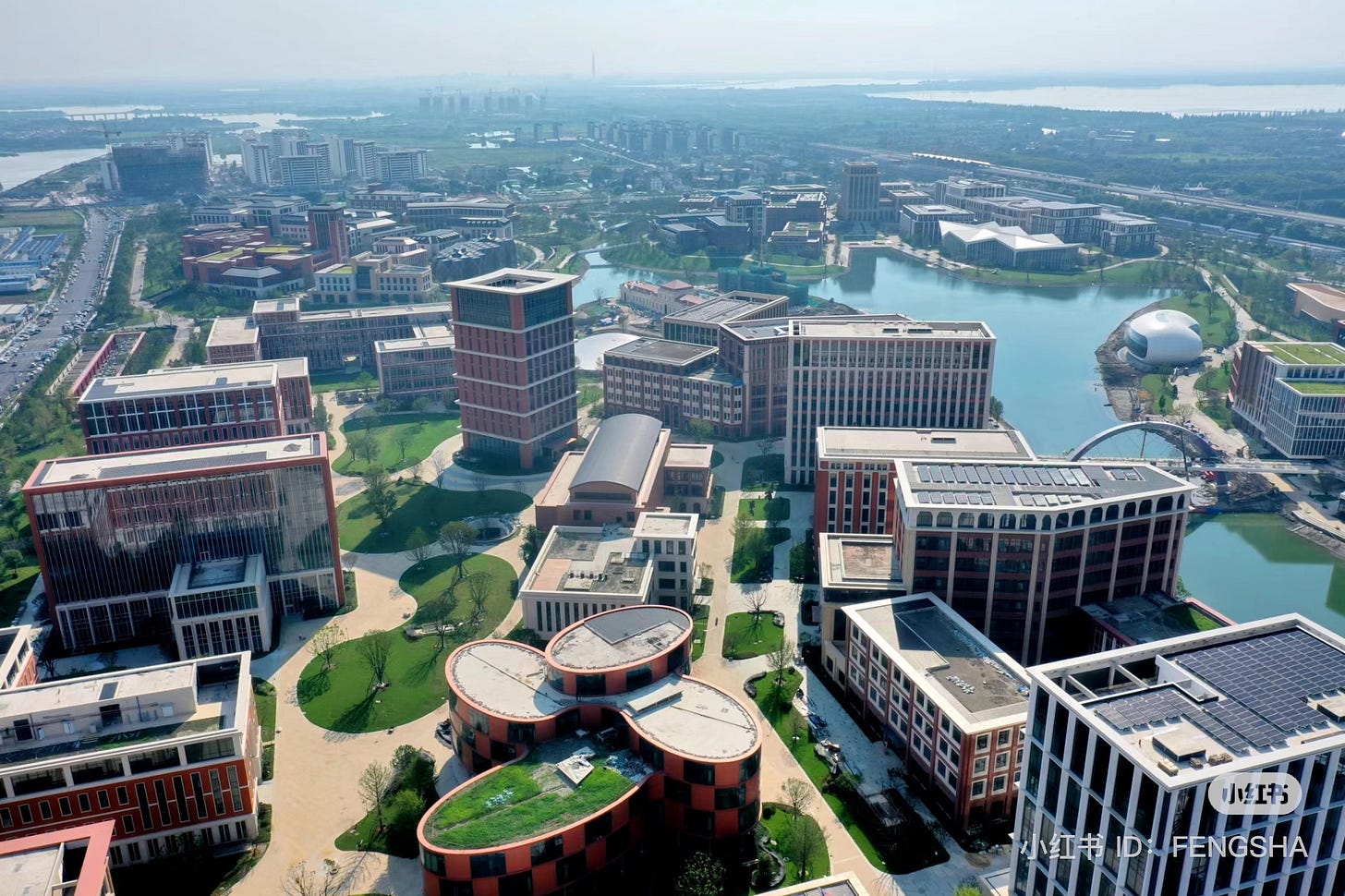
This project, located at the administrative boundary of three jurisdictions—Shanghai, Zhejiang, and Jiangsu literally symbolizes the idea of coordinated regional development with a not so subtle bridge stretching across the Huangpu River connecting three pavillions representing Shanghai, Zhejiang, and Jiangsu.
The following is a brief summary of my conversation with a planner from Tongji, and some additional info on other aspects of the project.
ME: What’s the purpose of the project:
PLANNER: “The thinking is these three provinces can strengthen cooperation, strengthen standardization,--for example—Jiangsu’s Suzhou—this area is where the water draining out from Taihu flows but for Shanghai this is the upstream source of the Huangpu river. So in the past, Suzhou didn’t really pay much attention to this area as it was on the edge of its jurisdiction, Same with Shanghai. The ecological requirements are the strictest element of the plan.”
ME: What are some of the obstacles?
PLANNER: “It’s a relatively unique project, but it’s not easy—politically its supported, but governments don’t have a lot of money right now. The market isn’t great so developers don’t want to spend money—this area is the meeting point of three provinces, they are all relatively far from the center of each jurisdiction, so linkages to central Shanghai, for example, are not great, but eventually the subway line 17 (Qingpu Line) will be extended here.
There are some things that have been agreed upon and some things that haven’t, but its not necessary to agree on everything..such as building standards, etc.
Yet, compared to other regions (such as Beijing-Tianjin-Hebei), its actually easier to do coordinated development here. Shanghai, Zhejiang, Jiangsu—these are all relatively similar developed provinces/directly ruled cities, so the resource gap between them isn’t as large as say between Beijing and Hebei.”
ME: What else is being coordinated?
“There also are ongoing efforts to integrate services, so that residents in one jurisdiction, for example in Shanghai can use hospitals in Jiangsu. But the idea is not for these three provinces to completely merge into one larger jurisdictions. The administrative borders are still there. And money is still mostly controlled by each jurisdiction. Also for worker’s certifications, the certificate would be recognized across the different jurisdictions. Hukou’s (household registration) will still be separate, but services can be shared.”
Overview of Watertown Lobby Project 水乡客厅
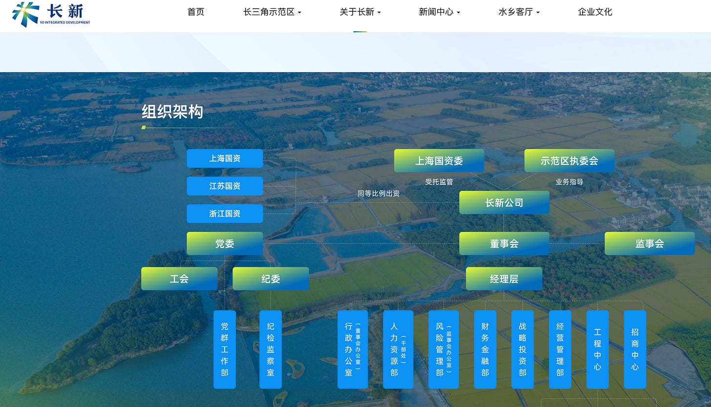
The Waterfront Lobby shuixiang keting is a 660 sq km centerpiece of the broader regional project (2300 sq km), as this area lies directly at the borders of the three jurisdictions. At the very center of the project is a “showpiece exhibition area” which comprises a bridge crossing over the Huangpu River, each pavillion represents one of the areas: one for Jiangsu, Shanghai, and Zhejiang. This project is being built by the government—specifically the Changxin Group 长新集团, a chengtou set up with capital investment from each of the three jurisdictions.
Overall the project is separated broadly into three zones, one of which lies in Shanghai, Jiangsu, and Zhejiang. The project is also separated into 18 smaller planning units within the shuixiang keting plan (18个单元).
New Office Areas: near the bridge exhibition building are three main new developments: on both the Shanghai and Jiangsu side are two low-rise office complex areas, meanwhile south of the bridge on the Zhejiang side is a new convention/hotel/tourism complex built with a water town Jiangnan style
Ecological Zones: There is a kind of ecological area on the Shanghai side for paddies separated by waterways; on the Jiangsu side there would be a ecological fishing area. There is still a question over the operational model that would be profitable to raise fish here, in a sustainable way so that water is treated as it moves through the different ponds.
Transportation Network: There would be an electric automated people mover type bus that would run along this loop (points to the loop running through the project). Each of the three zones would have a hub for electric vehicle charging/battery swapping. Passengers arriving by high-speed rail can transfer onto other modes here.

Nearby Industrial and Data Parks
The Waterfront Lobby area is only a small part of a much larger development zone. Already, Huawei recently completed its biggest research and development center not far from here (see below). The 16 billion RMB complex will supposedly host 30,000 R&D personnel working on Huawei's terminal chips, wireless networks, and Internet of Things (IoT) tech. There is also a new data center cluster with new data centers of China Mobile, Unicom, and Telecom being developed as part of the East-West Data Center Plan 东数西算, that I have written about here.
Huawei 华为基地
Conclusions
The Yangtze River Integrated Development Zone is still in an early development stage. But it is indicative of an effort by China’s planners and top-level policymakers to exert more centralized control and inter-provincial coordination onto what had been a very municipal-driven planning and development process over the last few decades. This “state entrepreneurialism” of municipal governments has been described by scholars of political economy, planning, and geography as a key aspect of China’s economic development model.3 However, in the “new era”, there has been an effort by central authorities to exert greater control so as to manage the “externalities” (sorry for the Economist speak) of municipal-led growth: arable land conversion, sprawl, excessive housing prices, and ecological pollution. Whether or to what degree this inter-jurisdictional control and coordination will be effective remains to be seen. The coordination between Shanghai-Zhejiang-and Jiangsu may be easier because all of the jurisdictions are quite similar in terms of levels of development and incomes and the economies are already quite well integrated. Other areas could be more difficult, such as between Beijing-Tianjin-and Hebei in the North. The outcome of coordinated governance could have a significant bearing on how China is able to manage its continued urbanization and development while mitigating challenges of ecological protection, climate change, and persistent urban-rural inequalities. These efforts will also have an important bearing on the balance of power between center, provincial, and local authorities.
Yumin Ye & Richard LeGates & Bo Qin, 2013. "Coordinated Urban-Rural Development Planning in China," Journal of the American Planning Association, Taylor & Francis Journals, vol. 79(2), pages 125-137, April.
Yansui Liu, Yang Zhou, “Territory spatial planning and national governance system in China,” Land Use Policy Volume 102, 2021, 105288 https://doi.org/10.1016/j.landusepol.2021.105288.
Wu, Fulong. 2020. “The State Acts through the Market: ‘State Entrepreneurialism’ beyond Varieties of Urban Entrepreneurialism.” Dialogues in Human Geography 10 (3): 326–29. https://doi.org/10.1177/2043820620921034; Wu, Fulong. 2015. Planning for Growth: Urban and Regional Planning in China. 1 edition. New York, NY: Routledge; Rithmire, Meg. 2015. Land Bargains and Chinese Capitalism. New York, NY: Cambridge University Press.


Thank you for sharing, so interesting! Do you think the ecological zones are actually planned for economic activity or just for window showing? I remember 崇明岛 had some similar ecological planning going on (not as integrated or complex as the 长三角 though)